Tours / Brooklyn
Self-guided walking tourBrooklyn Heights, DUMBO and Vinegar Hill
A MUSEENYC walking tour · Free, and not sponsored by anyone
- Distance
- 3 miles
- Time
- 3 hours
- Stops
- 14, 3 private (view from the sidewalk only)
- Start
- Brooklyn Bridge Park Pier 1 (A/C to High St)
- End
- Brooklyn Borough Hall (2/3/4/5/R to Borough Hall)
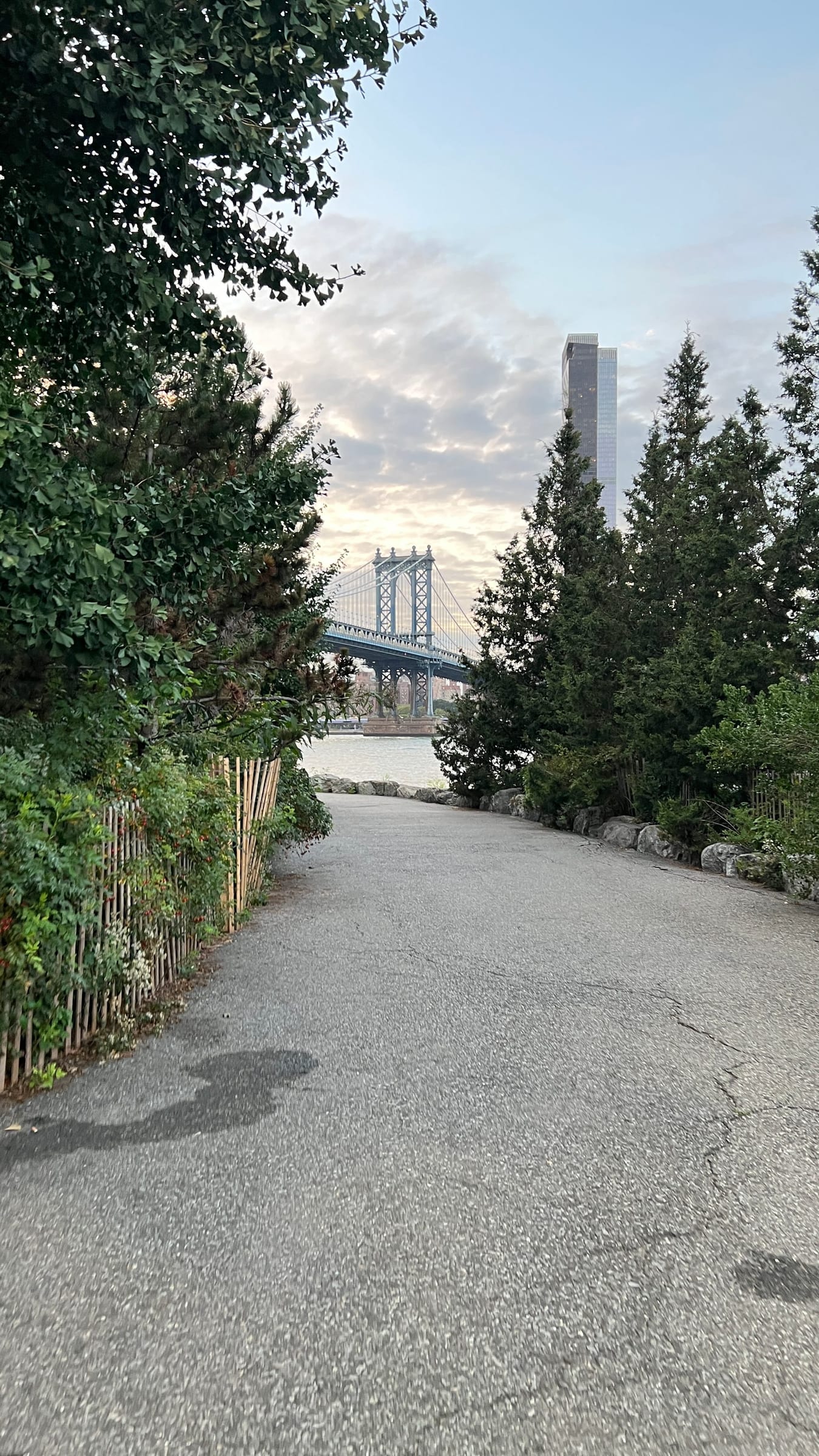
America's first suburb, plus the warehouse district below it. Start on the water, climb into the brownstones, end at the civic center. The Promenade view is the famous part, but the side streets are the real thing.
Route card
Screenshot this. Full detail for each stop is further down.
- 1Brooklyn Bridge Park, Pier 1
- 2Fulton Ferry Landing
- 3Jane's Carousel
- 4Empire Stores
- 5Washington Street at Water Street
- 6Vinegar Hill
- 7Brooklyn Navy Yard and BLDG 92Private — view from the sidewalk only
- 8Squibb Park Bridge
- 9Brooklyn Heights Promenade
- 10Willow Street, 20 to 26Private — view from the sidewalk only
- 11Plymouth Church
- 12Grace Court AlleyPrivate — view from the sidewalk only
- 13Montague Street
- 14Brooklyn Borough Hall
Private stops include people's homes: no gates, no doorways, no photographing into windows.
Get the map
The Google map for this tour is on its way. Until it's up, the walking navigation links below take you from stop to stop, and the printable guide has every stop in it.
Getting there and back
- Start
- A/C to High St, one block from Pier 1. Or F to York St for the DUMBO end. NYC Ferry to DUMBO/Fulton Ferry Landing.
- Finish
- 2/3/4/5 and R at Borough Hall-Court St, right at the last stop.
- Along the route
- B25 along Fulton St. B69 on Vanderbilt and Washington Ave. B61 and B57 through the Navy Yard side. NYC Ferry from Fulton Ferry Landing to Wall St and Midtown.
Cutting it short
Every walk here has exits. Good ones on this route:
- After stop 5 (Washington St): F at York St, three blocks east.
- After stop 7 (Navy Yard): F at York St, or B57/B69 on Flushing Ave.
- After stop 9 (Promenade): 2/3 at Clark St, two blocks inland.
- After stop 11 (Plymouth Church): A/C at High St, three blocks north.
The walk through Brooklyn Heights / DUMBO / Vinegar Hill, Brooklyn
1Brooklyn Bridge Park, Pier 1
Open to the publicBuilt on the footprint of a container terminal that closed in the 1980s. The lawn gives you the classic composition: Lower Manhattan across the water, Brooklyn Bridge to your right, Statue of Liberty to the left. Walk the granite steps at the north end down to the water.
Open in maps ↗40.70105, -73.99685
2Fulton Ferry Landing
Open to the publicWalk: North through the park past the granite steps, under the bridge. The landing is the wooden pier on your left.
For two centuries this was the only link between Brooklyn and Manhattan. Walt Whitman rode this ferry daily and wrote Crossing Brooklyn Ferry about it; lines from the poem are cut into the railing. The bridge opening in 1883 killed the ferry and the neighborhood emptied out for a hundred years.
Open in maps ↗40.70328, -73.99506
3Jane's Carousel
Open to the publicWalk: East along the water into the park lawn. The glass pavilion is ahead of you.
A restored 1922 Philadelphia Toboggan Company carousel, bought at auction and rebuilt over decades by Jane Walentas, then housed in a glass pavilion designed by Jean Nouvel. Riding it is optional. Seeing it lit at dusk with the bridge behind it is not.
Open in maps ↗40.70349, -73.99320
4Empire Stores
Open to the publicWalk: East on Water St one block. The brick warehouses are on your right and the courtyard cuts straight through the block.
Heads up: Roof terrace is free and most people miss it. Stairs are inside the courtyard.
Brick Civil War-era warehouses that stored coffee, sugar and molasses. The renovation punched a public courtyard straight through the block and put a free rooftop terrace on top. Take the stairs up. The roof view of the Manhattan Bridge is better than the one from the street.
Open in maps ↗40.70328, -73.99045
5Washington Street at Water Street
Open to the publicWalk: Out the east side, continue on Water St to Washington St. Stand in the middle of Washington and look uphill.
Heads up: Live street with traffic. Do not stand in the road for the photo.
The single most photographed spot in Brooklyn, and it is genuinely good: cobblestones running uphill, brick walls on both sides, the bridge tower filling the gap, and the Empire State Building lined up dead center behind it. Go early. By 10am it is a queue.
Open in maps ↗40.70365, -73.98950
6Vinegar Hill
Open to the publicWalk: East on Water St, under the Manhattan Bridge, then Plymouth St about 8 minutes to Hudson Ave.
Heads up: Quiet residential blocks. Keep your voice down and stay off stoops.
A pocket of Belgian-block streets and Federal row houses that survived because the Navy Yard and Con Edison boxed it in and nobody bothered to redevelop it. Hudson Avenue and Front Street are the core. It is residential and quiet, so keep your voice down. This is the closest you can get to walking through 1840s Brooklyn.
Open in maps ↗40.70335, -73.98177
7Brooklyn Navy Yard and BLDG 92
Private — view from the sidewalk onlyWalk: South on Hudson Ave to Sands St, then east to Flushing Ave. Building 92 is at Carlton Ave.
Or ride: B57 or B69 bus along Flushing Ave.
The yard built the Monitor and the Missouri and employed 70,000 people in World War II. It is now a working industrial park with more than 550 businesses. You can't wander the whole site, but the perimeter and the free BLDG 92 museum and visitor center, open Thursday to Sunday, show you the scale.
Open in maps ↗40.70085, -73.97740
8Squibb Park Bridge
Open to the publicWalk: Long stretch back west. Retrace Plymouth and Water St under both bridges, about 15 minutes, then up to Squibb Park.
Or ride: F train York St to Jay St, or A/C from High St. Faster if your legs are going.
A steel switchback bridge connecting Brooklyn Heights to the waterfront 30 feet below. The original wooden version bounced so much it had to be closed and rebuilt. Use it to climb from the park up into the neighborhood without a long detour.
Open in maps ↗40.70003, -73.99580
9Brooklyn Heights Promenade
Open to the publicWalk: Up the switchback bridge to Columbia Heights, then south. The Promenade entrance is at Orange St.
Robert Moses wanted the Brooklyn-Queens Expressway to cut through the Heights. The neighborhood fought him and the compromise was to stack the highway in two decks against the bluff and put a public esplanade on the roof. Traffic is directly under your feet and you can barely hear it. Walk the full length.
Open in maps ↗40.69609, -73.99694Our review →
10Willow Street, 20 to 26
Private — view from the sidewalk onlyWalk: Inland at Clark St, turn left on Willow St. Nos. 155-159 are the Federal houses right there; walk north toward Middagh for the rest.
Heads up: All private homes. Sidewalk only.
Willow Street is the best block in the Heights. Nos. 20 to 26 are 1840s Greek Revival; Nos. 155 to 159 further north are 1820s Federal houses with a tunnel rumored to connect them, long claimed as an Underground Railroad stop. All private. Look at the doorways, the ironwork, the bootscrapers.
Open in maps ↗40.69712, -73.99450
11Plymouth Church
Open to the publicWalk: East on Orange St one block to Hicks St. The church takes the whole block between Hicks and Henry.
Heads up: Sanctuary is open limited hours. Check before you build the day around it.
Henry Ward Beecher preached abolition from this pulpit and staged mock slave auctions to buy people's freedom. It was a major Underground Railroad station, nicknamed the Grand Central Depot of the railroad. Lincoln worshipped here twice. The sanctuary is plain on purpose. Check the visiting hours before you go.
Open in maps ↗40.69708, -73.99345
12Grace Court Alley
Private — view from the sidewalk onlyWalk: South on Hicks St about 6 blocks. Grace Court Alley is on your left just past Remsen St.
Or ride: B25 along Fulton St if you want to skip ahead to Borough Hall.
A dead-end alley of converted carriage houses that served the mansions on Remsen Street. Small, cobbled, easy to miss. Worth the two-minute detour for the doors alone.
Open in maps ↗40.69344, -73.99470
13Montague Street
Open to the publicWalk: North one block on Hicks, turn right on Montague St.
Not architecturally special, and that is the point: this is where the neighborhood actually shops and eats. Walk it east toward the courthouse for the transition from residential Heights to civic Brooklyn.
Open in maps ↗40.69425, -73.99380
14Brooklyn Borough Hall
Open to the publicWalk: East on Montague to Court St. Borough Hall is the Greek Revival building straight ahead.
Built as the city hall of the independent City of Brooklyn, the third-largest city in America before the 1898 consolidation. Greek Revival with a cast-iron cupola added later. Stand on the steps and look at the scale of what Brooklyn thought it was going to be.
Open in maps ↗40.69281, -73.99030
Combining this with other tours
- Tour 9 (Two Bridges) shares five stops with this one: Pier 1, Fulton Ferry Landing, Jane's Carousel, Empire Stores and Washington St. If you are doing Tour 9, you can skip those here and start this walk at the Squibb Park Bridge.
- Tour 9 in reverse drops you at Columbus Park in Chinatown, which is where Tour 7 starts. Bridge walk into a Chinatown walk is a strong full day.
- Tour 6 (Fort Greene) starts at BAM, a 15-minute walk or one stop on the 2/3 from Borough Hall where this tour ends.
Take it with you
Download the printable guideA PDF with every stop, direction and transit option, for when your battery or your signal gives out.
Want this one led in person?
This walk is free to follow and always downloadable above. We also lead it privately, for your party only: a licensed New York City Sightseeing Guide doing the navigating and the photographs while you look up at the city instead of at a map.
See private guided walksAbout MUSEENYC
MUSEENYC writes free guides to New York museums, neighborhoods and walks. Nothing here is sponsored, nothing is paid placement, and no one pays to be included.
Questions about a stop, a closure, or anything else on this walk? Reach MUSEENYC at museenyc.tours@gmail.com or @museenyc on Instagram.