Tours / Brooklyn
Self-guided walking tourWilliamsburg Bridge: Delancey to Domino
A MUSEENYC walking tour · Free, and not sponsored by anyone
- Distance
- 4 miles
- Time
- 3 to 3.5 hours
- Stops
- 13, 2 private (view from the sidewalk only)
- Start
- Essex Market (F/M/J/Z to Delancey St-Essex St)
- End
- Bedford Avenue, Williamsburg (L to Bedford Av)
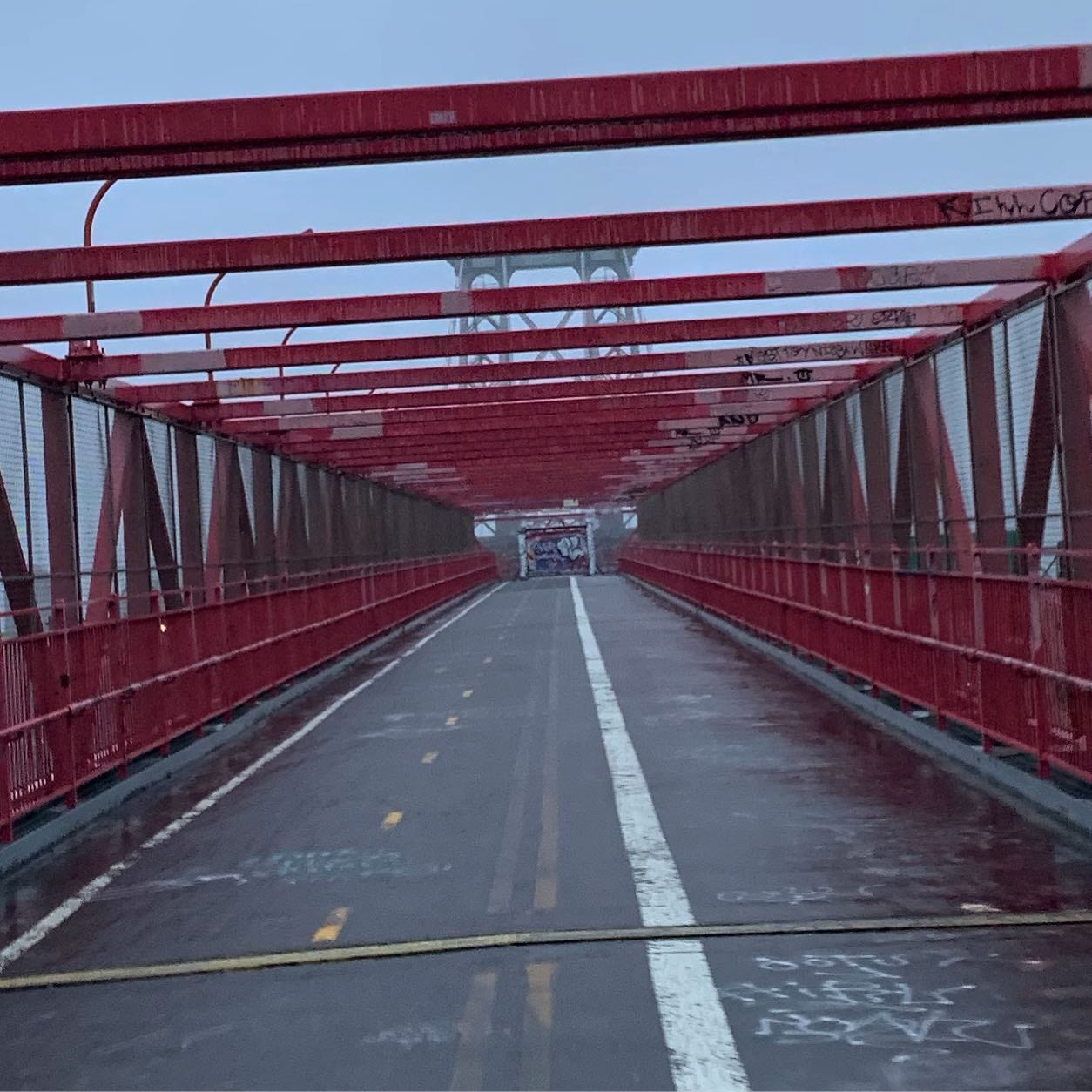
The bridge that built Williamsburg. When it opened in 1903, tens of thousands of people walked out of the most crowded square mile on earth and into cheap land on the other side, which is why the Lower East Side and South Williamsburg look like two halves of the same neighborhood. Walk it in that direction and the whole thing makes sense. The crossing is the longest of the three bridge walks and the least pretty: raw steel, chain-link, subway trains, graffiti. It is also the only one that still feels like infrastructure instead of a monument.
Route card
Screenshot this. Full detail for each stop is further down.
- 1Essex Market
- 2Seward Park
- 3Williamsburg Bridge pedestrian entrance
- 4Williamsburg Bridge, Manhattan tower
- 5Williamsburg Bridge, mid-span
- 6Williamsburg Bridge, Brooklyn approach
- 7Bridge exit at Bedford Avenue
- 8Williamsburgh Savings Bank, 175 BroadwayPrivate — view from the sidewalk only
- 9Kings County Savings Bank, 135 BroadwayPrivate — view from the sidewalk only
- 10Domino Park
- 11Grand Ferry Park
- 12Marsha P. Johnson State Park
- 13Bedford Avenue
Private stops include people's homes: no gates, no doorways, no photographing into windows.
Get the map
The Google map for this tour is on its way. Until it's up, the walking navigation links below take you from stop to stop, and the printable guide has every stop in it.
Getting there and back
- Start
- F/M/J/Z to Delancey St-Essex St. Essex Market is at the top of the stairs.
- Finish
- L at Bedford Av, one stop back to Manhattan. Or NYC Ferry from N 6th St.
- Along the route
- Manhattan side: F/M/J/Z at Delancey-Essex, F at East Broadway, M15 SBS on Allen St. Brooklyn side: J/M/Z at Marcy Av and Hewes St, L at Bedford Av and Lorimer St, G at Metropolitan Av. Buses: B32 on Kent Ave, B62 on Bedford and Driggs, B24 on Metropolitan, B39 over the bridge itself.
Cutting it short
Every walk here has exits. Good ones on this route:
- Before the bridge: the B39 bus crosses the bridge from Delancey-Essex to Marcy Av. It is the only bus that does. Use it if the walk is too much.
- After stop 7 (bridge exit): J/M/Z at Marcy Av, one block east.
- After stop 9 (Kings County Bank): J/M/Z at Marcy Av, two blocks.
- After stop 10 (Domino Park): L at Bedford Av, 10 minutes inland, or NYC Ferry at S Williamsburg.
- After stop 12 (Marsha P. Johnson Park): NYC Ferry at N 6th St, right there.
The walk through Lower East Side / Williamsburg, Brooklyn
1Essex Market
Open to the publicLa Guardia built the original to get pushcart vendors off the streets. The market moved across Delancey into a new building in 2019 and kept most of the old vendors: Dominican produce, a fishmonger, cheese, Mexican groceries. Start here and eat before the bridge, not after. Upstairs mezzanine has seating.
Open in maps ↗40.71850, -73.98800
2Seward Park
Open to the publicWalk: South on Essex St two blocks to Canal St and East Broadway. The park is the triangle.
Built by demolishing a block of tenements after reformers argued children needed somewhere to play besides the street. It opened the same year as the bridge, which is not a coincidence: both were answers to the same problem, which was that this was the densest place on the planet. One solution was to make room here. The other was to build a way out.
Open in maps ↗40.71410, -73.98960
3Williamsburg Bridge pedestrian entrance
Open to the publicWalk: North on Essex St to Delancey St, east three blocks to Clinton St. The ramp starts in the middle of Delancey.
Heads up: Get the side right. Walkers use the south path; the north path is for bikes, and you do not want to be on it.
The ramp climbs from the middle of Delancey Street. Look back west before you start: Delancey runs dead straight into the bridge, which is what a 1900s approach road looks like when it is built to move a hundred thousand people a day. Get the side right: walkers use the south path and cyclists the north, both starting from the ramp at Clinton St.
Open in maps ↗40.71830, -73.98450
4Williamsburg Bridge, Manhattan tower
Open to the publicWalk: Up the ramp and out, about 8 minutes to the tower.
Heads up: Look back down Delancey before you climb. It runs dead straight into the bridge.
Leffert L. Buck built the first major suspension bridge in the world with steel towers rather than masonry. It was cheap, fast and widely called ugly; critics said it looked like it had been assembled from a kit. It was also the longest suspension span on earth until 1924. Everything about it is exposed, which is the reason to walk it: you can see exactly how a suspension bridge works, because nothing is hiding.
Open in maps ↗40.71600, -73.98000Our review →
5Williamsburg Bridge, mid-span
Open to the publicWalk: Continue about 10 minutes to the high point over the river.
Heads up: Trains pass a few feet away and it is loud. Stop here anyway, it is the best view on the walk.
Stop in the middle. Downriver you get the Manhattan and Brooklyn Bridges stacked behind each other, which is a view you cannot get from either of them. Upriver, the Domino refinery and the Greenpoint waterfront. The J, M and Z run on tracks a few feet to your side and the noise is considerable. This bridge carried streetcars, elevated trains, cars and pedestrians all at once, and it still carries three of the four.
Open in maps ↗40.71340, -73.97330Our review →
6Williamsburg Bridge, Brooklyn approach
Open to the publicWalk: About 10 minutes down the Brooklyn side. The ramp runs low over the rooftops.
Heads up: South Williamsburg below you is a residential Hasidic neighborhood, not a sight. If you detour in, dress modestly and do not photograph people.
The Brooklyn ramp runs low over the neighborhood for a long stretch, so you come down through the rooftops rather than over them. Look left into the blocks below: this is South Williamsburg, home to one of the largest Hasidic communities in the world, settled here largely by Satmar refugees after 1945. It is a residential religious neighborhood, not an attraction. If you walk into it, dress modestly and do not photograph people.
Open in maps ↗40.71180, -73.96950Our review →
7Bridge exit at Bedford Avenue
Open to the publicWalk: Follow the path down to street level at Bedford Ave and S 5th Pl.
Forty-five minutes ago you were in the Lower East Side. The people who made this trip in 1904 were doing it permanently, with everything they owned. Williamsburg's population roughly doubled in the decade after the bridge opened and the LES emptied out at the same rate, which is why the bridge was nicknamed the Jewish Highway.
Open in maps ↗40.71030, -73.96540
8Williamsburgh Savings Bank, 175 Broadway
Private — view from the sidewalk onlyWalk: South on Bedford Ave two blocks to Broadway, then east half a block to No. 175.
Or ride: J/M/Z at Marcy Av is one block east if you want to cut the walk here.
Heads up: Broadway runs under the elevated tracks. Permanent shade, grand buildings, loud.
A cast-iron and stone dome by George B. Post, who later did the New York Stock Exchange. It went up when Williamsburg was a wealthy independent city of its own, before it was annexed to Brooklyn in 1855 and before Brooklyn was annexed to New York in 1898. The interior murals are by Peter B. Wight. It is an event space now, so the dome is what you get from the street. That is enough.
Open in maps ↗40.71000, -73.96590
9Kings County Savings Bank, 135 Broadway
Private — view from the sidewalk onlyWalk: One block west on Broadway to No. 135.
French Second Empire with a mansard roof, built for a bank founded by Williamsburg's own merchants. Broadway under the elevated tracks is one of the strangest good streets in the city: grand 19th-century commercial architecture in permanent shadow, with a subway rattling overhead. Walk a couple of blocks of it and look up past the trains.
Open in maps ↗40.71050, -73.96670
10Domino Park
Open to the publicWalk: North on Kent Ave about 10 minutes to S 5th St. The park entrance is on the water side.
Or ride: B32 bus north on Kent Ave.
Heads up: Go up on the elevated catwalk and look back at the bridge.
The Domino refinery processed over half the sugar consumed in the United States in the 1880s, and its workforce came largely off this bridge. The park keeps the syrup tanks, the gantry cranes and a raised catwalk you can walk. Stand on the catwalk and look back at the bridge you just crossed; the refinery and the bridge are the same story from two ends.
Open in maps ↗40.71410, -73.96730Our review →
11Grand Ferry Park
Open to the publicWalk: North on Kent Ave to Grand St, then west to the water. About 8 minutes.
Where the ferry to Manhattan ran before the bridge put it out of business, the same way Fulton Ferry died under the Brooklyn Bridge. Tiny, usually empty, and it has the best low-angle view of the Empire State Building across the water.
Open in maps ↗40.71750, -73.96900
12Marsha P. Johnson State Park
Open to the publicWalk: North on Kent Ave to N 8th St. About 10 minutes.
Or ride: B32 bus, or NYC Ferry at N 6th St if you want to leave by boat.
Heads up: Smorgasburg runs here Saturdays in season.
A 19th-century shipping terminal site with the original rail tracks and cobbles still set into the lawn. Renamed in 2020 for the activist and Stonewall figure. Smorgasburg runs here on Saturdays in season. Straight-on view of midtown across the river.
Open in maps ↗40.72300, -73.96350
13Bedford Avenue
Open to the publicWalk: East on N 8th or N 9th St to Bedford Ave, then walk south.
Or ride: L at Bedford Av, right there.
Heads up: Eyes above the ground floor. The storefronts changed; the buildings did not.
Walk Bedford south from N 9th with your eyes above the ground floor. The storefronts have turned over three times in twenty years; the buildings above them have not. End here, eat, and take the L one stop back under the river to where you started the day.
Open in maps ↗40.71750, -73.95700
Combining this with other tours
- Tour 3 (East Village to LES) shares stops 1 and 2 with this one. Run Tour 3 in the morning, stop at Seward Park, then start this tour at stop 3 and cross the bridge. That is a full day and it follows the actual migration route.
- Tour 8 (Greenpoint to Williamsburg) shares stops 10, 11, 12 and 13 with this one and ends by crossing this bridge in the opposite direction. Do not run both on the same day; pick a direction.
- Tour 8 in reverse plus this one makes a clean loop: cross here into Williamsburg, work north up the waterfront to Greenpoint, take the G back. About 6 miles.
- Tour 9 (Two Bridges) is the other half of the set. All three East River bridges in one day is roughly 9 miles and entirely doable: Brooklyn out, Manhattan back, lunch in Chinatown, then Williamsburg out from Delancey and the L home.
- Bridge-only version: stops 3 through 7. About 1.5 miles and 45 minutes, Delancey to Bedford Ave.
Take it with you
Download the printable guideA PDF with every stop, direction and transit option, for when your battery or your signal gives out.
Want this one led in person?
This walk is free to follow and always downloadable above. We also lead it privately, for your party only: a licensed New York City Sightseeing Guide doing the navigating and the photographs while you look up at the city instead of at a map.
See private guided walksAbout MUSEENYC
MUSEENYC writes free guides to New York museums, neighborhoods and walks. Nothing here is sponsored, nothing is paid placement, and no one pays to be included.
Questions about a stop, a closure, or anything else on this walk? Reach MUSEENYC at museenyc.tours@gmail.com or @museenyc on Instagram.